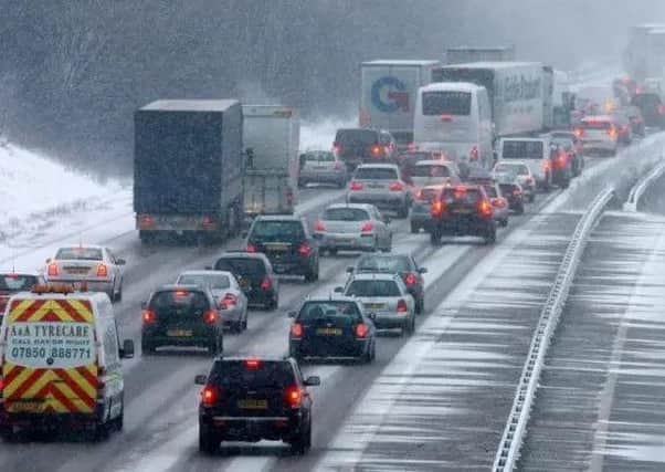
Snow and '˜significant' wind chill heading towards Sussex, Met Office announce


“After a mostly dry and settled second half to the week across the country, it will gradually become colder in the south with bitterly cold, but still dry weather, expected to develop across the south east during the weekend.
“As high pressure, currently centred over northern Britain, gradually migrates further north-eastwards, to become centred over Scandinavia, very cold air will spread from western Russia towards the UK.
Advertisement
Hide AdAdvertisement
Hide Ad“By Monday it will turn very cold more widely and this will probably be the start of the coldest spell of the winter.
“Many places will remain dry into the start of next week, but snow showers are expected to develop in some places, particularly across eastern and southern England.
“The cold easterly wind will persist bringing a significant wind chill which will make it feel several degrees colder than thermometers indicate.
“There is potential for some disruptive snowfall next week, although the likelihood of heavy snow in any given location is very difficult to gauge; some places could see some significant amounts of snow, while nearby locations may receive very little.
Advertisement
Hide AdAdvertisement
Hide Ad“At this stage, we consider the regions most likely to have disruptive snowfall are parts of east and south-east England.
“Here, disruption to travel is possible for the start of the working week.
“The high pressure over Scandinavia bringing the cold easterly flow is expected to remain in place for several days and there are signs that the cold spell in the UK is likely to last well into next week and perhaps into the following week.
“Met Office Deputy Chief Meteorologist, Brent Walker, said: ‘Whilst a major widespread snow event is currently not expected, some parts of south-east England could have the first significant spell of snow so far this winter during next week. Indeed, there is potential for this cold spell to be the coldest for several years in the south’.
Advertisement
Hide AdAdvertisement
Hide Ad“March 1st is the start of meteorological Spring, but this year the first week of March is likely to feel distinctly wintry.
“The cold spell and the slow-moving weather systems are linked to a meteorological event that happened high up in the Stratosphere over the North Pole recently.
“After a lag the Sudden Stratospheric Warming (SSW) 30km above the North Pole, is now having an impact on the weather in Northern Europe.
“As a result, the increased likelihood of a cold spell of weather has been forecast for many days, but there is now greater confidence about the time scale and also the extent of snowfall.
Advertisement
Hide AdAdvertisement
Hide Ad“Weather computer models, which previously showed marked variation, are now aligning, giving greater confidence about the timing and location of the cold weather.
“The Met office is working with partners in road, rail and air transport to help minimize the impacts on the public. Cold weather warnings have already been issued through Public Health England to help the National Health Service cope with increased health-related issues.
Dr Thomas Waite, of Public Health England’s Extreme Events team, said: “With the days feeling a little longer and lighter it can be easy to forget that cold weather can still kill.
“Over 65s, those with conditions like heart and lung diseases and young children, are all at particular risk in cold weather as their bodies struggle to cope when temperatures fall. So before it gets cold check on friends, family and neighbours, who may be at risk and make sure they’re heating homes to at least 18C, see if they need any particular help or just someone to talk to and keep an eye on the Met Office’s forecasts and warnings. Remember keeping warm will help keep you well.”